GIS Populate GeoReference XYZ
Navigate:  Valuation >
Configuration >
GIS Populate GeoReference XYZ
Valuation >
Configuration >
GIS Populate GeoReference XYZ
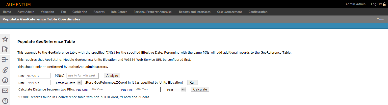
Description
The Populate GeoReference Table Coordinates screen allows you to produce Digital Elevation Model (DEM) elevation for the specified Longitude (X) and Latitude (Y).
Click here to learn how to change the Z Coordinate default.
The Z Coordinate default unit is feet (ft.). To change the default:
-
Click Configuration > Application Settings.
-
On the Maintain Application Settings screen, select Effective Date from the Setting type drop-down list, and select GeoAnalyst from the Filter by module drop-down list.
-
Locate Units Elevation and click Edit.
- In the Setting Value column, enter m for meters and click Apply.
- Click Save in the Command Item bar.
- Click Close to end the task.
Steps
-
On the Populate GeoReference Table Coordinates screen, enter a whole or partial PIN (use % for a wild card) in the PIN(s) field to find PINs that are not in the GeoReference table.
- Click Analyze. A message at the end of the screen shows how many PINs will be added and how many matching the pattern are already in the GeoReference table.
- Click Run.
-
Enter two PINs to calculate the distance between them, and make a selection from the unit of measurement drop-down list.
-
Click Calculate to add the PIN matches to the GeoReference table.
-
Click Close to end the task.
-
NOTE: The date will be used as the Effective Date in the stats, or select Calendar Period from the drop-down list.
Tips
When a new appraisal site is created, a new record is populated in the GeoReference table if corresponding records do not already exist. The XYZ coordinates of the centeroid to the parcel polygon are calculated by Aumentum.