WGS84 Web Service
Background
The WGS84 web service is used to generate a WGS84 latitude and longitude for a given parcel. This is used for GIS Browser Links, Pictometry, populating the GeoReference table when a new appraisal site is created, and for Find Potential Buyers. The URL is defined in the WGS84 Web Service URL within Aumentum.
Testing WGS84
NOTE: You must be on the server or configure localhost within host file to point to server.
On the server where WGS84 (applicationName) is installed, test the web service with http://localhost/WGS84/WebService.asmx.
Click on GetLatLon or GetLatLonZ and entering in a specific record into valuesCSV from the field that is configured.
NOTE: Aumentum does not support secure URL.
Testing Find Potential Buyers
-
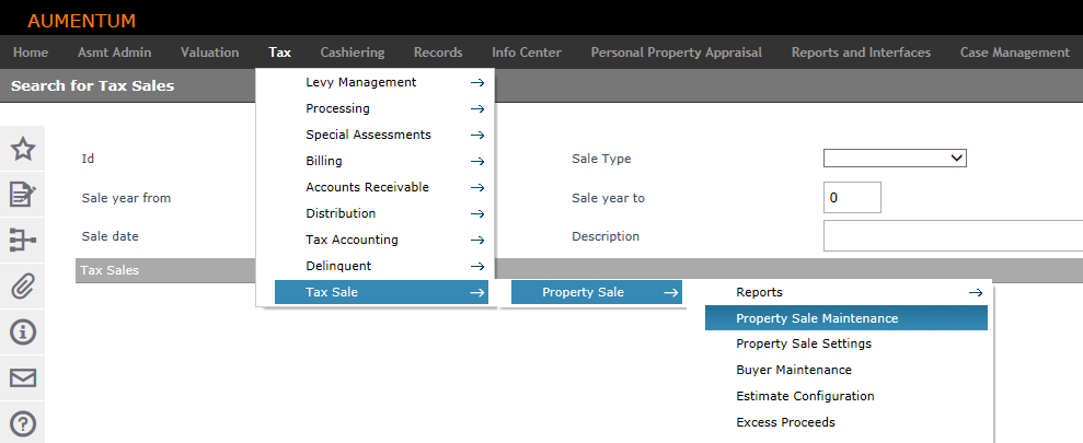
Click Tax > Tax Sale > Property Sale > Property Sale Maintenance.
-
On the Search for Tax Sales screen, enter your search criteria and click Search.
-
In the Tax Sales panel, click to select a row.
-
NOTE: Not every record will give you the next step option
-
On the Maintain Property Sales screen, hover over the Process Items drop-down list in the Tax Sale Items panel and select Find Potential Buyers.
-
This starts a batch process to find GetAbutters from the Tax Sale Items that are selected in the list.
-
Errors and Troubleshooting
If you get 0’s and the error message, The request failed with HTTP status 404: Service Not Found or Not Started, check the web.config and the map services on ArcGIS Server.
Service Not Found means it could not find a map service.
Ensure the batch server can communicate with the WGS84 Web Service URL.
Ensure GIS PINs exist.
PINs that are listed must be converted to GIS PINs and tested individually using the steps in the Testing WGS84 section of this topic.